
SD DARMEX LEDO LESTARI 1
| Nama | : | SD DARMEX LEDO LESTARI 1 | |
| NPSN | : | 69963951 | |
| Alamat | : | Blok O 22 Kebun Ledo 1 | |
| Desa/Kelurahan | : | SINAR BARU | |
| Kecamatan/Kota (LN) | : | KEC. JAGOI BABANG | |
| Kab.-Kota/Negara (LN) | : | KAB. BENGKAYANG | |
| Propinsi/Luar Negeri (LN) | : | PROV. KALIMANTAN BARAT | |
| Status Sekolah | : | SWASTA | |
| Bentuk Pendidikan | : | SD | |
| Jenjang Pendidikan | : | DIKDAS |
| Kementerian Pembina | : | Kementerian Pendidikan, Kebudayaan, Riset dan Teknologi | |
| Naungan | : | Yayasan Darmex | |
| NPYP | : | AF4007 | |
| No. SK. Pendirian | : | 171/DISDIKBUD/TAHUN 2017 | |
| Tanggal SK. Pendirian | : | 01-03-2017 | |
| Nomor SK Operasional | : | 420/042/DISDIKBUD-C.2 | |
| Tanggal SK Operasional | : | 26-05-2017 | |
| File SK Operasional () | : | Lihat SK Operasional | |
| Tanggal Upload SK Op. | : | 28-08-2021 12:12:52 | |
| Akreditasi | : | B |
| Luas Tanah | : | 5.000 m2 | |
| Akses Internet | : | 1. - | |
| : | 2. 3 Mb | ||
| Sumber Listrik | : | Diesel |
| Fax | : | - | |
| Telepon | : | ||
| : | sddarmexledolestari1@gmail.com | ||
| Website | : | ||
| Operator | : | YARWANTO |
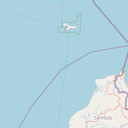

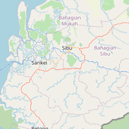
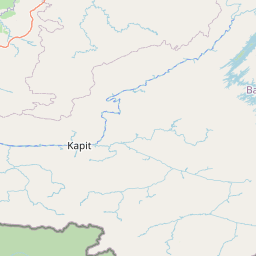

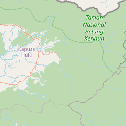

Leaflet | © OpenStreetMap
Lintang: 1.390616000000
Bujur: 109.619850000000
Bujur: 109.619850000000