
SMPN 2 BANYUASIN II
| Nama | : | SMPN 2 BANYUASIN II | |
| NPSN | : | 69946435 | |
| Alamat | : | Jalan Tanjung Api-Api | |
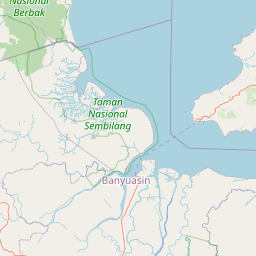
| Desa/Kelurahan | : | MUARA SUNGSANG | |
| Kecamatan/Kota (LN) | : | KEC. BANYUASIN II | |
| Kab.-Kota/Negara (LN) | : | KAB. BANYUASIN | |
| Propinsi/Luar Negeri (LN) | : | PROV. SUMATERA SELATAN | |
| Status Sekolah | : | NEGERI | |
| Bentuk Pendidikan | : | SMP | |
| Jenjang Pendidikan | : | DIKDAS |
| Kementerian Pembina | : | Kementerian Pendidikan, Kebudayaan, Riset dan Teknologi | |
| Naungan | : | Pemerintah Pusat | |
| NPYP | : | - | |
| No. SK. Pendirian | : | NOMOR 89 TAHUN 2016 | |
| Tanggal SK. Pendirian | : | 27-06-2016 | |
| Nomor SK Operasional | : | NOMOR 89 TAHUN 2016 | |
| Tanggal SK Operasional | : | 20-06-2016 | |
| File SK Operasional () | : | Lihat SK Operasional | |
| Tanggal Upload SK Op. | : | 24-08-2020 19:18:29 | |
| Akreditasi | : | B |
| Luas Tanah | : | 8.008 m2 | |
| Akses Internet | : | 1. - | |
| : | 2. 5 Mb | ||
| Sumber Listrik | : | PLN |
| Fax | : | - | |
| Telepon | : | ||
| : | smpn4banyuasin22016@gmail.com | ||
| Website | : | http://smpn4banyuasinii.go.id | |
| Operator | : | NURHAENI |
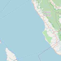
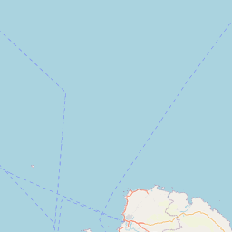

Leaflet | © OpenStreetMap
Lintang: -1.822765500000
Bujur: 104.368019800000
Bujur: 104.368019800000