
SMA MUHAMMADIYAH NUNUKAN
| Nama | : | SMA MUHAMMADIYAH NUNUKAN | |
| NPSN | : | 69888489 | |
| Alamat | : | JL. MULAWARMAN ,RT.7 NUNUKAN TIMUR | |
| Desa/Kelurahan | : | NUNUKAN TIMUR | |
| Kecamatan/Kota (LN) | : | KEC. NUNUKAN | |
| Kab.-Kota/Negara (LN) | : | KAB. NUNUKAN | |
| Propinsi/Luar Negeri (LN) | : | PROV. KALIMANTAN UTARA | |
| Status Sekolah | : | SWASTA | |
| Bentuk Pendidikan | : | SMA | |
| Jenjang Pendidikan | : | DIKMEN |
| Kementerian Pembina | : | Kementerian Pendidikan, Kebudayaan, Riset dan Teknologi | |
| Naungan | : | Yayasan Pimpinan Wilayah Muhammadiyah (PWM) Prov. Kalimantan Utara | |
| NPYP | : | AH9813 | |
| No. SK. Pendirian | : | 188.4/022/DISDIK-IV/II/2014 | |
| Tanggal SK. Pendirian | : | 17-02-2014 | |
| Nomor SK Operasional | : | 188.4/022/DISDIK-IV/II/2014 | |
| Tanggal SK Operasional | : | 17-02-2014 | |
| File SK Operasional () | : | Lihat SK Operasional | |
| Tanggal Upload SK Op. | : | 31-08-2020 08:32:50 | |
| Akreditasi | : | C |
| Luas Tanah | : | 4.524 m2 | |
| Akses Internet | : | 1. - | |
| : | 2. 500 Mb | ||
| Sumber Listrik | : | PLN |
| Fax | : | - | |
| Telepon | : | 055623600 | |
| : | smamuhnnk@gmail.com | ||
| Website | : | http://smamuhnunukan.sch.id | |
| Operator | : | Rhina Dwi Yulianti |
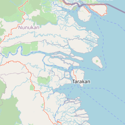

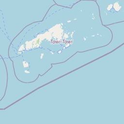


Leaflet | © OpenStreetMap
Lintang: 4.140600000000
Bujur: 117.658700000000
Bujur: 117.658700000000