
SD SWASTA BUMITAMA
| Nama | : | SD SWASTA BUMITAMA | |
| NPSN | : | 69787635 | |
| Alamat | : | Rt. 13 Rw. 007 Dusun Koto Baru | |
| Desa/Kelurahan | : | PENDALIAN | |
| Kecamatan/Kota (LN) | : | KEC. PENDALIAN IV KOTO | |
| Kab.-Kota/Negara (LN) | : | KAB. ROKAN HULU | |
| Propinsi/Luar Negeri (LN) | : | PROV. RIAU | |
| Status Sekolah | : | SWASTA | |
| Bentuk Pendidikan | : | SD | |
| Jenjang Pendidikan | : | DIKDAS |
| Kementerian Pembina | : | Kementerian Pendidikan, Kebudayaan, Riset dan Teknologi | |
| Naungan | : | Yayasan BUMITAMA FOUNDATION | |
| NPYP | : | AO2400 | |
| No. SK. Pendirian | : | 243 | |
| Tanggal SK. Pendirian | : | 27-04-2012 | |
| Nomor SK Operasional | : | 421-2/DPPO-DIKdas-LB/2610 | |
| Tanggal SK Operasional | : | 11-06-2012 | |
| File SK Operasional () | : | Lihat SK Operasional | |
| Tanggal Upload SK Op. | : | 14-11-2022 09:07:09 | |
| Akreditasi | : | B |
| Luas Tanah | : | 10.000 m2 | |
| Akses Internet | : | 1. - | |
| : | 2. 500 Mb | ||
| Sumber Listrik | : | Diesel |
| Fax | : | - | |
| Telepon | : | ||
| : | sdsbumitamapnde@gmail.com | ||
| Website | : | http://www.sdbumitamapendalian4koto.sch.id | |
| Operator | : | Wahda Leni, S.Pd |
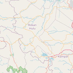
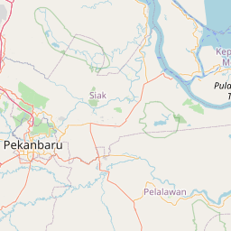
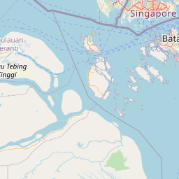

Leaflet | © OpenStreetMap
Lintang: .469500000000
Bujur: 100.457300000000
Bujur: 100.457300000000