
SD NEGERI MARIRIMAR
| Nama | : | SD NEGERI MARIRIMAR | |
| NPSN | : | 60101743 | |
| Alamat | : | Maririmar | |
| Desa/Kelurahan | : | MARIRIMAR | |
| Kecamatan/Kota (LN) | : | KEC. ARU TENGAH | |
| Kab.-Kota/Negara (LN) | : | KAB. KEPULAUAN ARU | |
| Propinsi/Luar Negeri (LN) | : | PROV. MALUKU | |
| Status Sekolah | : | NEGERI | |
| Bentuk Pendidikan | : | SD | |
| Jenjang Pendidikan | : | DIKDAS |
| Kementerian Pembina | : | Kementerian Pendidikan, Kebudayaan, Riset dan Teknologi | |
| Naungan | : | Pemerintah Daerah | |
| NPYP | : | - | |
| No. SK. Pendirian | : | .1975 | |
| Tanggal SK. Pendirian | : | 12-10-1975 | |
| Nomor SK Operasional | : | 420/478/VII/2023 | |
| Tanggal SK Operasional | : | 12-10-1975 | |
| File SK Operasional () | : | Lihat SK Operasional | |
| Tanggal Upload SK Op. | : | 02-09-2023 21:12:59 | |
| Akreditasi | : | C |
| Luas Tanah | : | 4.750 m2 | |
| Akses Internet | : | 1. - | |
| : | 2. - | ||
| Sumber Listrik | : | PLN |
| Fax | : | - | |
| Telepon | : | ||
| : | |||
| Website | : | ||
| Operator | : | JOHN SAHERTIAN |
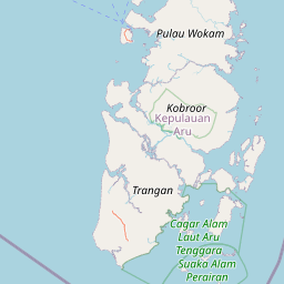

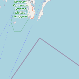


Leaflet | © OpenStreetMap
Lintang: -6.029376700000
Bujur: 134.385033300000
Bujur: 134.385033300000