
SD NEGERI 1 BANGKELEKILA
| Nama | : | SD NEGERI 1 BANGKELEKILA | |
| NPSN | : | 40306352 | |
| Alamat | : | Lome | |
| Desa/Kelurahan | : | LEMBANG TAMPAN BONGA | |
| Kecamatan/Kota (LN) | : | KEC. BANGKELEKILA | |
| Kab.-Kota/Negara (LN) | : | KAB. TORAJA UTARA | |
| Propinsi/Luar Negeri (LN) | : | PROV. SULAWESI SELATAN | |
| Status Sekolah | : | NEGERI | |
| Bentuk Pendidikan | : | SD | |
| Jenjang Pendidikan | : | DIKDAS |
| Kementerian Pembina | : | Kementerian Pendidikan, Kebudayaan, Riset dan Teknologi | |
| Naungan | : | Pemerintah Daerah | |
| NPYP | : | - | |
| No. SK. Pendirian | : | 62/DP-TU/Dikdas.1/IV/2014 | |
| Tanggal SK. Pendirian | : | 01-01-1910 | |
| Nomor SK Operasional | : | 106/DP-TU/SD/VI/2024 | |
| Tanggal SK Operasional | : | 01-04-2024 | |
| File SK Operasional () | : | Lihat SK Operasional | |
| Tanggal Upload SK Op. | : | 04-09-2024 21:35:05 | |
| Akreditasi | : | B |
| Luas Tanah | : | 6.720 m2 | |
| Akses Internet | : | 1. - | |
| : | 2. 30 Mb | ||
| Sumber Listrik | : | PLN |
| Fax | : | - | |
| Telepon | : | ||
| : | sdn1bangkelekila@gmail.com | ||
| Website | : | ||
| Operator | : | AGNESIA ARIANTI AMPING |


Leaflet | © OpenStreetMap
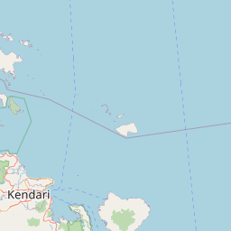
Lintang: -2.900900000000
Bujur: 119.932900000000
Bujur: 119.932900000000