
SMP NEGERI 1 PELING TENGAH
| Nama | : | SMP NEGERI 1 PELING TENGAH | |
| NPSN | : | 40200212 | |
| Alamat | : | Jl. Siswa No. 12 | |
| Desa/Kelurahan | : | PATUKUKI | |
| Kecamatan/Kota (LN) | : | KEC. PELING TENGAH | |
| Kab.-Kota/Negara (LN) | : | KAB. BANGGAI KEPULAUAN | |
| Propinsi/Luar Negeri (LN) | : | PROV. SULAWESI TENGAH | |
| Status Sekolah | : | NEGERI | |
| Bentuk Pendidikan | : | SMP | |
| Jenjang Pendidikan | : | DIKDAS |
| Kementerian Pembina | : | Kementerian Pendidikan, Kebudayaan, Riset dan Teknologi | |
| Naungan | : | Pemerintah Daerah | |
| NPYP | : | - | |
| No. SK. Pendirian | : | 38 | |
| Tanggal SK. Pendirian | : | 30-03-2004 | |
| Nomor SK Operasional | : | - | |
| Tanggal SK Operasional | : | 01-01-1910 | |
| File SK Operasional () | : | Lihat SK Operasional | |
| Tanggal Upload SK Op. | : | 02-10-2023 13:38:02 | |
| Akreditasi | : | A |
| Luas Tanah | : | 26.000 m2 | |
| Akses Internet | : | 1. - | |
| : | 2. - | ||
| Sumber Listrik | : | PLN |
| Fax | : | - | |
| Telepon | : | ||
| : | smpnsatupelingtengah@gmail.com | ||
| Website | : | ||
| Operator | : | SAMSIA DUKE |
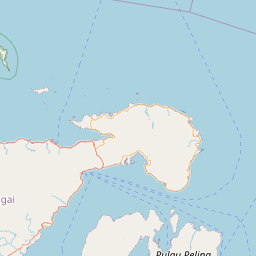


Leaflet | © OpenStreetMap
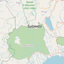
Lintang: -1.423000000000
Bujur: 123.173200000000
Bujur: 123.173200000000