
SD NEGERI 35 KECAMATAN PONTIANAK UTARA
| Nama | : | SD NEGERI 35 KECAMATAN PONTIANAK UTARA | |
| NPSN | : | 30105108 | |
| Alamat | : | Jln. Selat Panjang | |
| Desa/Kelurahan | : | SIANTAN HULU | |
| Kecamatan/Kota (LN) | : | KEC. PONTIANAK UTARA | |
| Kab.-Kota/Negara (LN) | : | KOTA PONTIANAK | |
| Propinsi/Luar Negeri (LN) | : | PROV. KALIMANTAN BARAT | |
| Status Sekolah | : | NEGERI | |
| Bentuk Pendidikan | : | SD | |
| Jenjang Pendidikan | : | DIKDAS |
| Kementerian Pembina | : | Kementerian Pendidikan, Kebudayaan, Riset dan Teknologi | |
| Naungan | : | Pemerintah Daerah | |
| NPYP | : | - | |
| No. SK. Pendirian | : | 421.3560/PD-PK-AP | |
| Tanggal SK. Pendirian | : | 16-10-1986 | |
| Nomor SK Operasional | : | 421.3560/PD-PK-AP | |
| Tanggal SK Operasional | : | 16-10-1986 | |
| File SK Operasional () | : | Lihat SK Operasional | |
| Tanggal Upload SK Op. | : | 08-12-2023 14:35:10 | |
| Akreditasi | : | A |
| Luas Tanah | : | 3.453 m2 | |
| Akses Internet | : | 1. - | |
| : | 2. 50 Mb | ||
| Sumber Listrik | : | PLN |
| Fax | : | 0 | |
| Telepon | : | 0 | |
| : | burhanuddin771@yahoo.com | ||
| Website | : | ||
| Operator | : | Burhanuddin |
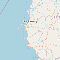


Leaflet | © OpenStreetMap
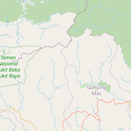
Lintang: -.014300000000
Bujur: 109.378200000000
Bujur: 109.378200000000