
SMKS 17 AGUSTUS 1945 MUNCAR
| Nama | : | SMKS 17 AGUSTUS 1945 MUNCAR | |
| NPSN | : | 20525605 | |
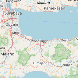
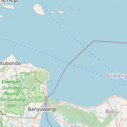
| Alamat | : | JL. RAYA BLAMBANGAN NO. 37 MUNCAR | |
| Desa/Kelurahan | : | BLAMBANGAN | |
| Kecamatan/Kota (LN) | : | KEC. MUNCAR | |
| Kab.-Kota/Negara (LN) | : | KAB. BANYUWANGI | |
| Propinsi/Luar Negeri (LN) | : | PROV. JAWA TIMUR | |
| Status Sekolah | : | SWASTA | |
| Bentuk Pendidikan | : | SMK | |
| Jenjang Pendidikan | : | DIKMEN |
| Kementerian Pembina | : | Kementerian Pendidikan, Kebudayaan, Riset dan Teknologi | |
| Naungan | : | Yayasan YAPENAS 17 AGUSTUS 1945 BANYUWANGI | |
| NPYP | : | AB3875 | |
| No. SK. Pendirian | : | 712/34.U/1987 | |
| Tanggal SK. Pendirian | : | 01-07-1987 | |
| Nomor SK Operasional | : | 179/18.02.05/02/VI/2023 | |
| Tanggal SK Operasional | : | 30-06-2023 | |
| File SK Operasional () | : | Lihat SK Operasional | |
| Tanggal Upload SK Op. | : | 23-06-2023 09:09:17 | |
| Akreditasi | : | B |
| Luas Tanah | : | 4.863 m2 | |
| Akses Internet | : | 1. - | |
| : | 2. 200 Mb | ||
| Sumber Listrik | : | PLN |
| Fax | : | 0333592170 | |
| Telepon | : | 0333592170 | |
| : | smkagustus1945muncar@gmail.com | ||
| Website | : | http://smk17muncar.sch.id | |
| Operator | : | YOGA DWITARA |

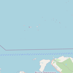

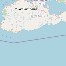

Leaflet | © OpenStreetMap
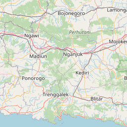
Lintang: -8.429600000000
Bujur: 114.306900000000
Bujur: 114.306900000000