
SMAS AL HASANIYYAH KARANGAWEN
| Nama | : | SMAS AL HASANIYYAH KARANGAWEN | |
| NPSN | : | 20319327 | |
| Alamat | : | JL. KAUMAN NGRAJEK | |
| Desa/Kelurahan | : | JRAGUNG | |
| Kecamatan/Kota (LN) | : | KEC. KARANGAWEN | |
| Kab.-Kota/Negara (LN) | : | KAB. DEMAK | |
| Propinsi/Luar Negeri (LN) | : | PROV. JAWA TENGAH | |
| Status Sekolah | : | SWASTA | |
| Bentuk Pendidikan | : | SMA | |
| Jenjang Pendidikan | : | DIKMEN |
| Kementerian Pembina | : | Kementerian Pendidikan, Kebudayaan, Riset dan Teknologi | |
| Naungan | : | Yayasan AL HASANIYYAH DEMAK | |
| NPYP | : | AL5614 | |
| No. SK. Pendirian | : | NOMOR AHU-0033172.AH.01.04 Tahun 2016 | |
| Tanggal SK. Pendirian | : | 23-08-2016 | |
| Nomor SK Operasional | : | 503.2/1496 | |
| Tanggal SK Operasional | : | 01-12-2003 | |
| File SK Operasional () | : | Silakan Upload SK (link file tidak valid) => [931142-309099--] | |
| Tanggal Upload SK Op. | : | 31-08-2023 20:22:20 | |
| Akreditasi | : | B |
| Luas Tanah | : | 2.820 m2 | |
| Akses Internet | : | 1. - | |
| : | 2. 3 Mb | ||
| Sumber Listrik | : | PLN |
| Fax | : | - | |
| Telepon | : | 6282136495493 | |
| : | hasaniyyah@gmail.com | ||
| Website | : | http://komunitas-al-hasaniyah.blogspot.com | |
| Operator | : | PIPIT NADIA |
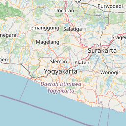

Leaflet | © OpenStreetMap
Lintang: -7.122000000000
Bujur: 110.552900000000
Bujur: 110.552900000000