
SMKS TERPADU TAQWA BELITANG
| Nama | : | SMKS TERPADU TAQWA BELITANG | |
| NPSN | : | 10603342 | |
| Alamat | : | JALAN MARGA PEMUKA BANGSA RAJA | |
| Desa/Kelurahan | : | GUMAWANG | |
| Kecamatan/Kota (LN) | : | KEC. BELITANG | |
| Kab.-Kota/Negara (LN) | : | KAB. OGAN KOMERING ULU TIMUR | |
| Propinsi/Luar Negeri (LN) | : | PROV. SUMATERA SELATAN | |
| Status Sekolah | : | SWASTA | |
| Bentuk Pendidikan | : | SMK | |
| Jenjang Pendidikan | : | DIKMEN |
| Kementerian Pembina | : | Kementerian Pendidikan, Kebudayaan, Riset dan Teknologi | |
| Naungan | : | YAYASAN AT-TAQWA GUMAWANG | |
| NPYP | : | AF2404 | |
| No. SK. Pendirian | : | 109/I11/KP/1998 | |
| Tanggal SK. Pendirian | : | 08-08-1998 | |
| Nomor SK Operasional | : | 800/10290/SK/SMK.3/Disdik.SS/2019 | |
| Tanggal SK Operasional | : | 17-09-2019 | |
| File SK Operasional () | : | Lihat SK Operasional | |
| Tanggal Upload SK Op. | : | 27-01-2022 15:00:17 | |
| Akreditasi | : | A |
| Luas Tanah | : | 5.926 m2 | |
| Akses Internet | : | 1. - | |
| : | 2. 30 Mb | ||
| Sumber Listrik | : | PLN & Diesel |
| Fax | : | 0735451023 | |
| Telepon | : | 0735451023 | |
| : | smk_terpadutakwabelitang@yahoo.co.id | ||
| Website | : | http://https://smkterpadutakwabelitang.sch.id | |
| Operator | : | ikrom |
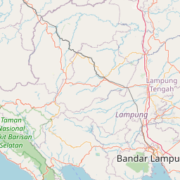
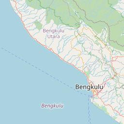


Leaflet | © OpenStreetMap
Lintang: -4.228300000000
Bujur: 104.578600000000
Bujur: 104.578600000000