
SMK SWASTA BUSTANUL YATAMA
| Nama | : | SMK SWASTA BUSTANUL YATAMA | |
| NPSN | : | 10112955 | |
| Alamat | : | JLN. IRIGASI KRUENG PASEE | |
| Desa/Kelurahan | : | TUMPEUN | |
| Kecamatan/Kota (LN) | : | KEC. SYAMTALIRA BAYU | |
| Kab.-Kota/Negara (LN) | : | KAB. ACEH UTARA | |
| Propinsi/Luar Negeri (LN) | : | PROV. ACEH | |
| Status Sekolah | : | SWASTA | |
| Bentuk Pendidikan | : | SMK | |
| Jenjang Pendidikan | : | DIKMEN |
| Kementerian Pembina | : | Kementerian Pendidikan, Kebudayaan, Riset dan Teknologi | |
| Naungan | : | Yayasan Pendidikan Islam dan Panti Asuhan Diniah Islamiyah Bustanul Yatama | |
| NPYP | : | AN2492 | |
| No. SK. Pendirian | : | 010/YYS/SMK/BY/2009 | |
| Tanggal SK. Pendirian | : | 16-07-2009 | |
| Nomor SK Operasional | : | 420/III.3/336/2010 | |
| Tanggal SK Operasional | : | 20-04-2010 | |
| File SK Operasional () | : | Lihat SK Operasional | |
| Tanggal Upload SK Op. | : | 20-11-2018 09:51:04 | |
| Akreditasi | : | B |
| Luas Tanah | : | 20.460 m2 | |
| Akses Internet | : | 1. - | |
| : | 2. - | ||
| Sumber Listrik | : | PLN |
| Fax | : | - | |
| Telepon | : | ||
| : | bustanul_yatama21@yahoo.com | ||
| Website | : | http://dapo.dikdasmen.kemdikbud.go.id | |
| Operator | : | Anwar, S.EI |
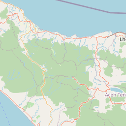
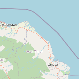
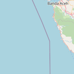


Leaflet | © OpenStreetMap
Lintang: 5.011900000000
Bujur: 97.124800000000
Bujur: 97.124800000000